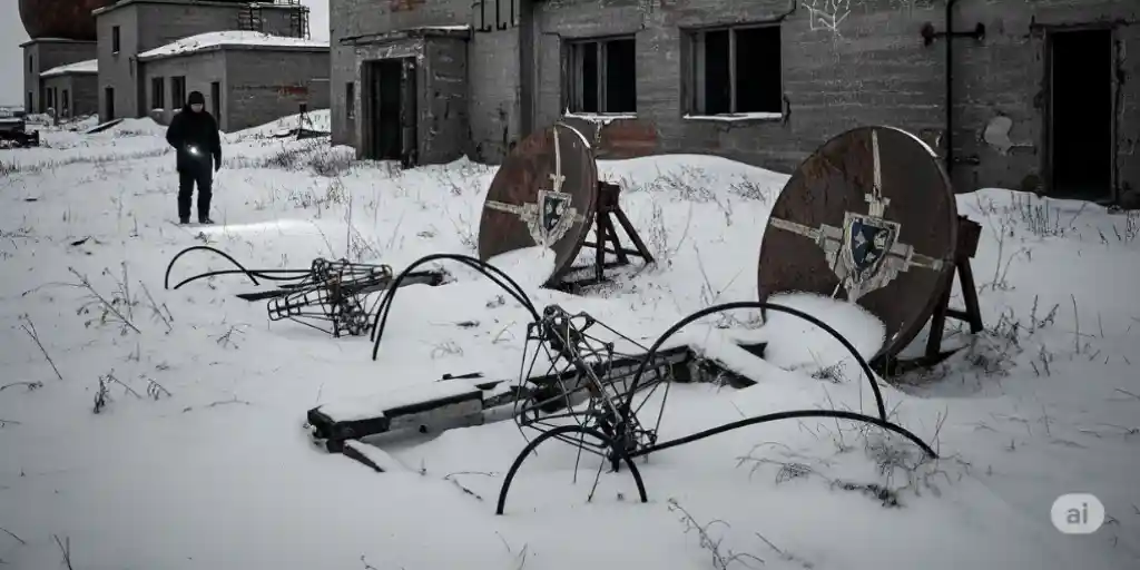
On mountaintops, Arctic edges, and hidden plains lie abandoned radar domes, crumbling bunkers, and surveillance towers—remnants of a world frozen in nuclear tension. These Cold-War radar stations once scanned the skies for missiles, planes, and enemies that never came. Now? They stand silent—part relic, part ruin.
In this blog, we’ll explore what remains of Cold-War radar infrastructure, where to find these eerie sites, and how to visit or research them responsibly. From DEW lines to Soviet outposts, this is a journey through the skeletons of skywatch.
🔍 What Were Cold-War Radar Stations?
Radar stations were military installations built to detect incoming threats during the Cold War (1947–1991), typically:
-
Equipped with long-range radar and communication towers
-
Built in remote, elevated, or coastal locations
-
Staffed 24/7 by military personnel
-
Used for missile warning, airspace defense, and early detection
Many were part of secret or multinational programs—and not all were documented.
💡 Why Were So Many Abandoned or Forgotten?
After the Cold War:
-
Technology advanced (satellites, drones)
-
Geopolitical threats shifted or reduced
-
Sites were too remote or expensive to maintain
-
Some were classified and quietly decommissioned
So yes—many radar stations were simply left to the wild.
✈️ Major Cold-War Radar Networks & What Remains
| Radar Line or Program | Region | What’s Left Today |
| DEW Line (Distant Early Warning) | Arctic USA/Canada | Rusted domes, towers, and airstrips |
| Soviet PVO (Air Defense) | Russia, Central Asia | Bunkers, radar pads, and overgrown bases |
| ROTOR Radar Stations | United Kingdom | Underground bunkers, empty towers |
| SAGE System Sites (USA) | Continental US | Abandoned control rooms and radar domes |
| Type 80/84 Sites (Europe) | NATO regions | Some converted, others left in ruins |
🛡️ Top Tricks to Explore or Research Cold-War Radar Sites
Here’s how urban explorers, historians, and Cold-War enthusiasts find and safely navigate these mysterious military leftovers.
1. ✅ Use Declassified Military Maps and Reports
Why it matters: Many radar sites were secret—but now partially unclassified.
Research Hack:
-
Check the CIA FOIA archives, NATO Cold-War studies, and Canadian DEW Line PDFs.
-
Use old topographic military maps to pinpoint former locations.
2. 🛰️ Find Sites with Satellite View Before Visiting
The trap: Many are inaccessible, remote, or gone.
Why it helps:
-
Domes and towers often show clear round shapes or roads in satellite view.
Exploration Tip:
-
Use Google Earth, Zoom Earth, or Gaia GPS to scout ruins.
-
Look for fence patterns, radar pads, or airstrips near coastlines or cliffs.
3. 🪖 Contact Local History Groups or Veterans
Problem: Official channels may give you nothing.
Why it’s powerful:
-
Locals or ex-military may know exact locations and access rules.
Radar Tip:
-
Join forums like Cold War Relic Hunters or contact retired military associations.
-
Many are happy to share maps, photos, and memories.
4. 📸 Explore Responsibly If On-Site
Why it matters: Some sites are unstable, toxic, or restricted.
Explorer Rule:
-
Don’t trespass. If accessible, wear sturdy shoes, gloves, and mask.
-
Radar towers may contain asbestos, rusted metal, or chemical remnants.
5. 🏛️ Visit Converted Radar Museums and Lookouts
Problem: Not every site can be visited as a ruin.
Radar Hack:
-
Many Cold-War sites were turned into museums, weather stations, or parks.
-
Examples: Hack Green (UK), North Bay DEW (Canada), St. Albans Radar Tower (USA).
💳 Best Resources to Study or Visit Radar Relics in 2025
| Source/Tool | Purpose | Extra Feature |
| Subterranea Britannica | Cold-War UK bunkers and sites | GPS + visitor guides for ROTOR stations |
| Cold War Bunkers Map (Google) | Global radar + missile site pins | User-submitted locations |
| CIA FOIA Reading Room | Declassified radar program files | Searchable Cold-War documents |
| Forgotten Airfields | Radar + defense strip history | Airbase ruins and radar links |
| Abandoned America / Derelict Places | Photo essays + safety tips | Radar ruins with entry notes |
🔍 Real User Example
“I found an old radar dome on the coast of Greenland using Cold War maps and satellite view. The dome was torn open, snow-covered, and full of echoes. It felt like a ghost was watching the sky.” – Marcus, Military Explorer
🧠 Pro Tips to Remember
-
Always verify local laws before visiting radar sites
-
Use offline maps—many sites are in signal-dead zones
-
Pack gloves, flashlight, and mask for safety
-
Never enter sealed bunkers or climb unstable towers
-
Respect these places—they were once frontline defense posts
💬 Final Thoughts: From Skywatch to Silence
These radar stations once watched the world with tension and fear. Today, they stand as forgotten sentinels, waiting for history’s curious eyes. To visit them is to touch the Cold War—not in textbooks, but in steel and dust.
✅ Don’t just explore—decode the past.
✅ Don’t just research—walk the ruins.
✅ Don’t just remember—rediscover.
The Cold War is over—but its radars still whisper.
📌 FAQs About Cold-War Radar Stations
Q1. Can I legally visit radar ruins?
Some yes, others are on restricted or private land. Always check local laws.
Q2. Are these places safe?
Many aren’t. Proceed with extreme caution—some contain hazardous materials.
Q3. Are there still active Cold-War-era radar stations?
A few have been repurposed for weather tracking, air traffic, or education.
Q4. Why didn’t governments dismantle them all?
Costs, secrecy, or remoteness often made abandonment easier than removal.